
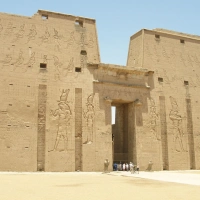
Remains of Galilee's 2,000-year-old Roman Road
The Hike the Bible series is currently covering points of interest along two hiking trails through Galilee, the 40-mile Jesus Trail and the 39-mile Gospel Trail. These two trails re-create possible routes Jesus likely traversed during His sojourns in Galilee.
After discussing the Galilean points of interest, this Hike the Bible series will continue with reviews of other major hiking trails in the Lands of the Bible.
Roman Road
Between Ilaniya and Lavi on both the Jesus Trail and the Gospel Trail are the ruins of an old Roman road (pictured above) that Jesus likely used.
In Jesus’ day it was part of a major east-west thoroughfare that ran from Acre on the Mediterranean to Tiberias on the Sea of Galilee. It was also part of a major trade route, the Via Maris (Way of the Sea), that cut through Galilee on its way to Syria from the Mediterranean coast.
Via Maris
In Bible times three major north-south trade routes through Israel connected Egypt in the south with Turkey, Syria, and Mesopotamia to the north. The King’s Highway ran east of the Jordan River. The Ridge Route ran on top of a range of low mountains through the middle of Israel between the Jordan and the Mediterranean Sea. The Coastal Highway or the Via Maris (as it was known under the Roman Empire) ran along the Mediterranean coast.
The Via Maris ran from Egypt in the south along the coast up to Megiddo in Israel where it split into two branches. The western coastal branch continued along the coast, while the eastern inland branch went through Galilee to Magdala on the Sea of Galilee and then on to Damascus where it crossed the King’s Highway. The inland branch was also known as the Great Trunk Road and was the busier of the two branches of the Via Maris.
The Roman Road ruin in the picture above was part of the eastern branch of the Via Maris through Galilee.
The Via Maris trade route probably goes back at least to the time of Abraham 4,000 years ago. Abraham and Isaac probably used it when they traveled back and forth to Egypt. The Midianite traders on their way to Egypt (who bought Joseph from his brothers) were probably on the Via Maris. The Via Maris runs near Dothan where Joseph found his brothers and was sold to the Midianites by them. (Genesis 37:15-28)

Here are links to maps which show the Via Maris:
Pilgrim Map of the Holy Land (interactive)
BibArch Trade Routes map
One of Isaiah’s Messianic prophesies (around 700 BC) describes the location of Zebulun and Naphtali as “by the Way of the Sea” or the Via Maris (Isaiah 9:1). The inland branch of the Via Maris ran right through Zebulun and Naphtali. The map at the right shows the location of these two tribes.
Matthew 4:12-16 reports that Jesus’ move from Nazareth to Capernaum fulfilled this prophecy. Capernaum was in Naphtali near the Via Maris.
Joseph and Mary probably escaped to Egypt along either the Via Maris or the King’s Highway. Joseph surely used the Via Maris when he returned and settled in Nazareth (Matthew 2:13-14, 19-23).
When Saul journeyed from Jerusalem to persecute Christians, he probably took the Ridge Route from Jerusalem to the inland Via Maris and then on to Damascus by the Via Maris where he met Jesus as he neared Damascus (Acts 9:1-9).
Roman Road System
The Roman road system comprised 250,000 miles of roads, including 50,000 miles of paved roads. At the height of the Roman Empire, 29 major highways radiated from Rome. The road system covered western Europe, advanced well into Britain, and extended throughout Spain, northern Africa, and the Middle East.

Major Roads in the Roman Empire during the rule of Hadrian (117-138 AD)
The Romans started building their road network about 500 BC, so the Roman road through Galilee is at least 2,000 years old and possibly as much as 2,500 years old. The route that it followed goes back at least to the time of Abraham.
The Romans had little interest in adapting their roads to local topography. They cut through hills and mountains and filled valleys to build level roads. Some are still in use today, and others “paved” the way for today’s roads which follow the same routes as the Roman roads. Roman bridges were so well built that some are still used.
Roman roads were marked every mile with milestones. These stone pillars listed distances to nearby cities along the roads. A mile (milia passuum) was 1,000 paces (double-steps) by a Roman soldier.
The road network’s primary purposes were to move armies, to develop trade, and to aid communication. For centuries it also greatly facilitated the spread of the Gospel throughout the Roman world. At the end of the empire, the roads served as invasion routes for the barbarian hordes that overran Rome.
Soli Deo Gloria.
This is the ninth installment in the Hike the Bible series reviewing major hiking trails in the Lands of the Bible.
Read the prequels:
1. Hike the Bible – Jesus Trail (with video)
2. Hike the Bible – Gospel Trail (with video)
3. Hike the Bible – Jesus Trail vs. Gospel Trail
4. Hike the Bible – Nazareth
5. Hike the Bible – Zippori
6. Hike the Bible – Mash’had
7. Hike the Bible – Cana (with video)
8. Hike the Bible – Roman Road
Read the sequel:
10. Hike the Bible – Horns of Hattin

Subscribe – Don’t miss future blog posts!
Click the sidebar’s “SUBSCRIBE” button to follow the
Bible-Science Guy Blog. You’ll automatically receive
new posts free by email. Click SUBSCRIBE NOW!
©William T. Pelletier, Ph.D.
“contending earnestly for the faith”
“destroying speculations against the knowledge of God”
(Jude 1:3; 2 Cor 10:4)
Wednesday March 21, 2012 A.D.
Read my March 2012 newspaper column:
Hike the Bible
Jesus was going throughout all Galilee, teaching in their synagogues and proclaiming the gospel of the kingdom, and healing every kind of disease and every kind of sickness among the people. (Matthew 4:23)


What do you think? Leave a comment. Please pray for the worldwide impact of the Bible-Science Guy ministry!